
Hurricane Trudy strengthens to Category 2 near Mexico's Pacific coast
Hurricane Trudy regained Category 2 strength Saturday with 100 mph winds as it neared Mexico's coast between Manzanillo and Cabo Corrientes, where forecasters expect hurricane conditions tonight and up to a foot of rain.
AI-assisted · US Brief desk · Sources listed below
What happened
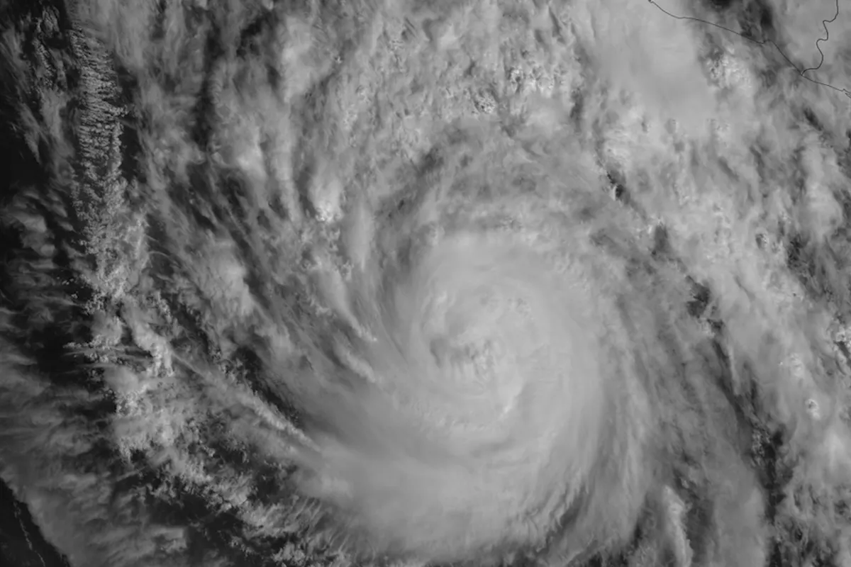
Hurricane Trudy strengthened back to Category 2 on Saturday afternoon after an Air Force Reserve Hurricane Hunter aircraft measured stronger winds, the U.S. National Hurricane Center (NHC) said. In its 5 p.m. PT update, the NHC put the center about 100 miles southwest of Manzanillo and 175 miles south of Cabo Corrientes, moving northwest at 10 mph with maximum sustained winds near 100 mph and a minimum pressure of 976 millibars.
Why it matters
The warning area includes Manzanillo, one of Mexico's main Pacific cargo ports, and sits just south of Puerto Vallarta, a major destination for American travelers, which falls in the tropical storm warning zone. Port closures halt shipping and tourist boats until the storm passes, and the NHC warns that the heaviest rain could set off life-threatening flooding and mudslides in steep terrain.
More context
A hurricane warning covers Mexico's coast from Manzanillo north to Cabo Corrientes, with a hurricane watch from south of Manzanillo to Punta San Telmo. Tropical storm warnings run from south of Manzanillo to Lázaro Cárdenas, from north of Cabo Corrientes to San Blas, and for the Islas Marías. The NHC expects the center to pass near the coast tonight and Sunday, with some more strengthening possible tonight and weakening starting late Sunday as Trudy turns west-northwest, away from land. Hurricane-force winds reach up to 35 miles from the center and tropical-storm-force winds up to 140 miles. Forecasters expect 4 to 8 inches of rain, with isolated totals near 12 inches, in Michoacán, Colima and Jalisco, plus dangerous storm surge and rip currents.
On the ground: Colima state's civil protection agency closed beaches in Manzanillo, Tecomán and Armería, closed the port of Manzanillo to all vessels and opened six temporary shelters in Manzanillo, Tecomán, Armería and Comala, La Jornada reported. In Jalisco, state authorities activated the early warning system on the north coast and raised red flags on Puerto Vallarta's beaches. The regional harbor master ordered the ports of Puerto Vallarta, Cabo Corrientes and Tomatlán closed to all boats from 7 p.m. local time Saturday, according to Reporte Diario Vallarta, and Mayor Luis Munguía said the city was considering reopening emergency shelters, Vallarta Daily reported.
Two forecasts, one track: The NHC and Mexico's Navy (SEMAR) broadly agree. SEMAR's 4 p.m. Mexico City time advisory projected the center about 102 kilometers (55 nautical miles) southwest of Cabo Corrientes by midday Sunday, still a Category 2 with sustained winds of about 157 km/h (roughly 98 mph), and about 151 kilometers west-northwest of Cabo Corrientes as a Category 1 by midnight Sunday. SEMAR forecast waves of 16 to 20 feet near the storm and 12 to 18 feet along the coasts of Jalisco, Colima, Michoacán, Guerrero and Oaxaca.
How Trudy got here, from the NHC's advisories: On Tuesday, Oct. 13, Tropical Depression Twenty-One-E formed about 540 miles south-southeast of Acapulco, and the first advisory forecast rapid strengthening to a major hurricane by Friday. It became Tropical Storm Trudy by Wednesday morning (60 mph) and a hurricane on Thursday, reaching 105 mph that night. Early Friday it was a major Category 3 hurricane with 120 mph winds, and a hurricane warning went up for the coast. By Friday afternoon, Hurricane Hunters found it had fallen to Category 1 (85 mph). The NHC called the reasons speculative, saying one possibility was that the slow-moving storm had churned up cold water where earlier storms Polo and Rachel had passed. It held near 90 mph overnight before regaining Category 2 strength Saturday.
What remains unknown: whether Trudy's center moves onshore or stays just off the coast, how much it strengthens tonight before the expected weakening, and how much damage the wind and rain cause. The sources cited here had not reported deaths or damage as of Saturday evening. The NHC's next full advisory is due at 9 p.m. CST (8 p.m. PT).
9 listed sources
- National Hurricane Center, Hurricane Trudy Intermediate Advisory 18A, Oct. 17, 2026
- National Hurricane Center, Hurricane Trudy advisory archive (advisories 1–18), Oct. 13–17, 2026
- National Hurricane Center, Hurricane Trudy Discussion 14, Oct. 16, 2026
- National Hurricane Center, Tropical Depression Twenty-One-E Advisory 1, Oct. 13, 2026
- Mexican Navy (SEMAR), tropical cyclone advisory for Hurricane Trudy, Oct. 17, 2026
- AP, Oct. 17, 2026
- La Jornada, Oct. 17, 2026
- Reporte Diario Vallarta, Oct. 17, 2026
- Vallarta Daily, Oct. 17, 2026
References listed by US Brief; a source count is not a verification score.
Editorial sourcing notes
Position, wind, pressure, warning areas and rainfall figures come from the National Hurricane Center's intermediate advisory 18A, issued at 6 p.m. CST (5 p.m. PT) on Oct. 17, and its Oct. 13–17 advisory archive. The Mexican Navy forecast is from its 4 p.m. Mexico City time advisory the same day. Local closures and shelters come from La Jornada, Reporte Diario Vallarta and Vallarta Daily reports citing state and port authorities. Conditions are changing quickly; check the NHC for the latest advisory. The photos are file images and do not show current conditions.
Like US Brief? You can support it with a tip.