
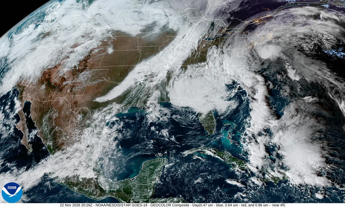
Gusts over 50 mph possible as Thanksgiving storm heads up East Coast
A storm forecast to form off Florida on Wednesday and move up the East Coast on Thanksgiving Day could bring gusts well over 50 mph near the mid-Atlantic coast, coastal flooding and heavy rain, the National Weather Service said Sunday, as 81.5 million Americans plan holiday trips.
AI-assisted · US Brief desk · Sources listed below
What happened
Forecasters on Sunday firmed up the outlook for a strong storm on Thanksgiving Day. The National Weather Service's Weather Prediction Center said in its 3 p.m. EST discussion that the storm "remains on track to bring heavy rain, strong winds and high surf to the East Coast," with some wintry weather possible from the central Appalachians into the interior Northeast.
Why it matters
AAA projects 81.5 million Americans will travel at least 50 miles from home between Tuesday, Nov. 24, and Monday, Nov. 30, including 72.9 million by car and 5.96 million on domestic flights. Domestic round-trip Thanksgiving flights average $800, 17% more than last year, according to AAA booking data, so missed connections could be costly to rebook.
More context
How it forms: The center said a low-pressure system should form near Florida's coast on Wednesday, then strengthen rapidly as it moves up the East Coast on Thanksgiving Day. AccuWeather described the same storm taking shape in the Gulf on Tuesday, spreading over the Southeast on Wednesday and reaching the Northeast and Midwest Wednesday night and Thursday. AccuWeather vice president Dan DePodwin called it a "potential nor'easter" that "comes at a time when millions of people are traveling."
Wind and coast: Easterly winds near the mid-Atlantic coast could possibly gust "well over 50 mph," and coastal flooding, beach erosion and dangerously rough seas "appear likely," especially from the mid-Atlantic to the New England coast, the Weather Prediction Center said. It said bursts of heavy rain and embedded thunderstorms could move inland later Thanksgiving Day and that night. AccuWeather said winds could cause sporadic power outages along parts of the Atlantic Seaboard and the Appalachians. In New York City, AccuWeather meteorologist Dan Pydynowski told the New York Post to expect a high near 50 on Thursday, winds of 12 to 25 mph and gusts of 30 to 40 mph, with the heaviest rain in the afternoon and evening.
Snow: Most places should be too warm for snow at first. The Weather Prediction Center said minor to moderate snow is possible in parts of the central Appalachians, upstate New York and interior New England, and some wet snow could fall from the Midwest to the lower Great Lakes from late Wednesday into Friday morning. AccuWeather said Chicago, Indianapolis and Detroit could see wet snow or a rain-snow mix on Thanksgiving Day, but meteorologist Brandon Buckingham said it would take "a major injection of cold air" to bring a heavy snowstorm to the Midwest.
Airports: AccuWeather expects airline delays in Orlando and Miami on Tuesday and Wednesday, in Atlanta and Charlotte on Wednesday, then spreading to Washington, Philadelphia, New York, Boston, Detroit and perhaps Chicago on Thanksgiving Day. Delays at those hubs can ripple to flights nationwide.
The parade: The 100th Macy's Thanksgiving Day Parade steps off at 8:30 a.m. ET Thursday in Manhattan. New York City rules ground the giant balloons if sustained winds top 23 mph or gusts top 34 mph, and the parade itself goes on in any weather, Fox Weather reported. AccuWeather said that even if rain holds off Thursday morning, winds are likely to make the balloons hard to handle.
Before the holiday: A separate low moving up the coast is spreading rain into the Carolinas and mid-Atlantic and is expected to bring travel delays to New York and Boston into Monday, weather.com said, with coastal flooding at high tide likely from the Virginia Tidewater to New England as the full moon brings monthly peak tides Tuesday. In the West, AccuWeather said a stronger-than-average Pacific storm tapping an atmospheric river will hit from western Washington to Northern California Monday night through Wednesday, with possible significant delays on Interstate 5 between Seattle and Sacramento and on mountain routes such as I-80. The Weather Prediction Center flagged a risk of flooding rain from Northern California to Washington's Olympic Peninsula on Wednesday and Thursday.
Florida: More downpours late Tuesday into Wednesday night could worsen flooding along the St. Johns River, which has already set records this month, AccuWeather said. Melbourne has had 22.59 inches of rain this month through Nov. 19, its wettest month in records dating to 1937, according to weather.com.
Travel timeline (forecasters, AAA and INRIX): - Sun., Nov. 22-Mon., Nov. 23: Rain and wind in the Northeast; delays possible in New York and Boston. - Tue., Nov. 24: Storm takes shape in the Gulf, per AccuWeather; West Coast storm arrives. INRIX says the worst driving times are 2 to 8 p.m.; go before 1 p.m. - Wed., Nov. 25: Heavy rain and storms in the Southeast, including Atlanta and Charlotte; low forms near Florida. Worst driving times are noon to 7 p.m.; go before noon. - Thu., Nov. 26: Storm moves up the East Coast; strongest winds, coastal flooding and parade-balloon risk. - Fri., Nov. 27-Sat., Nov. 28: Wet snow or snow showers possible in the Appalachians, eastern Great Lakes and northern New England as the storm exits. - Sun., Nov. 29: Heavy return traffic from noon to 8 p.m.; INRIX says go before 11 a.m.
How the forecasts differ: The Weather Prediction Center said computer models still disagree on the track. The American GFS model takes the storm as far inland as Pennsylvania, while one run of the Canadian model kept it farthest east. The averages of the American and European ensemble runs keep it on a coastal track, and the center said that track is still favored. AccuWeather said a storm that tracks over the Midwest, or one that forms on the coast and slips out to sea, would mean less intense wind and rain in the Northeast, though rain would still spread north.
What's still unknown: The storm had not formed as of Sunday, so its exact track, peak winds and inland snow totals are uncertain. Whether gusts in Manhattan cross the 34 mph balloon limit during parade hours is not yet known. Forecasters advise checking updated forecasts before leaving.
7 listed sources
- NWS Weather Prediction Center (Kong), Extended Forecast Discussion, 3 p.m. EST Nov. 22, 2026
- AccuWeather (Alex Sosnowski), Thanksgiving storm could snarl travel, upend plans in East, Central US, updated Nov. 22, 2026
- AccuWeather (Alex Sosnowski), Storms could slow US Thanksgiving travel on both coasts with rain East, rain and snow West, updated Nov. 22, 2026
- New York Post (Emily Lefroy), Here's what NYC can expect on Thanksgiving as monster storm barrels up coast, Nov. 22, 2026
- weather.com (Jonathan Erdman and Jonathan Belles), East Coast storm to bring rain, wind for millions along I-95 corridor, updated Nov. 22, 2026
- Fox Weather (Kieran Sullivan), Will Macy's Thanksgiving Day Parade balloons fly this year?, Nov. 19, 2026
- AAA Newsroom (Aixa Diaz), Thanksgiving Travel Expected to Dip Slightly Compared to Last Year, Nov. 16, 2026
References listed by US Brief; a source count is not a verification score.
Editorial sourcing notes
Updated Nov. 22, 2026, with Sunday forecasts from the National Weather Service's Weather Prediction Center (3 p.m. EST discussion), AccuWeather, weather.com and the New York Post. The Thanksgiving storm had not formed as of Sunday, so its track, wind speeds and snow totals can still change. The hero image is a NOAA GOES-19 satellite image from 12:26 p.m. PT Sunday, Nov. 22, and shows this weekend's weather, not the Thanksgiving storm. Travel numbers are AAA projections; drive times are INRIX estimates published by AAA.
Like US Brief? You can support it with a tip.