
Super Typhoon Champi skirts Guam, passing about 10 miles offshore
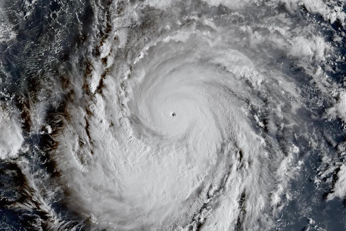
Champi's eye passed about 10 miles south of Guam's southern tip early Sunday local time, sparing the U.S. territory a direct hit, before strengthening into a 150 mph super typhoon as it moved away; damage reports are still to come.
AI-assisted · US Brief desk · Sources listed below
What happened
Super Typhoon Champi passed just south of Guam early Sunday local time (midday Saturday in the continental U.S.), and its eye stayed offshore. National Weather Service meteorologist Landon Aydlett said the center passed about 10 miles south of the southern village of Malesso' (Merizo) and about 21 miles south of central Guam, the Pacific Daily News reported. The weather service then upgraded Champi to a super typhoon with 150 mph sustained winds as it moved away to the west-northwest at 16 mph.
Why it matters
Guam is a U.S. territory and home to major U.S. military bases, and a direct hit had been possible until the last few hours. The southward track kept the worst winds over the far south, with central Guam forecast for Category 1 to 2 winds and the north for Category 1. The Pacific Daily News said Champi is the third super typhoon to affect Guam in the past year, which weather service meteorologist David DeCou called "certainly unusual."
What’s next
Guam stays in Condition of Readiness 1, and residents are told to stay indoors until officials announce COR 4. The weather service expected typhoon conditions to ease by Sunday afternoon, with tropical storm conditions into Sunday night. A Typhoon Warning remained in effect for Guam and Rota. The Guam Power Authority says hospitals, emergency services, water wells and ports get power back first. Champi could reach Category 5 by late Monday morning as it moves away from the Marianas.
More context
The far south still took the strongest winds. The weather service issued an extreme wind warning until 5:30 a.m. for Talo'fo'fo', Inalåhan, Malesso', Sånta Rita-Sumai and Humåtak. Guam's Joint Information Center warned of 110 to 135 mph winds there that could cause "significant to catastrophic damage," especially to non-concrete buildings. Citing the weather service, the Pacific Daily News reported that the island lost power shortly after 5 a.m., the PGUA Doppler radar was down by 6 a.m., and the airport recorded gusts of about 80 mph.
"This is good news for us. It was looking grim for us," Aydlett said on a weather service livestream. "Be thankful we dodged a major strike with this event." On Saturday evening he had called Champi "very comparable to Typhoon Mawar," the Category 4 storm that hit Guam in May 2023.
Timeline (Guam time, 17 hours ahead of Pacific time): Saturday 5:51 p.m., Champi has 130 mph winds about 140 miles east-southeast of Guam. 11:04 p.m., it is about 100 miles southeast. Sunday 1:12 a.m., winds reach 140 mph. 3:52 a.m., extreme wind warning for the southern villages. About 5 a.m., closest approach just south of the island, and the power goes out. 6:46 a.m., upgraded to a super typhoon at 150 mph, about 45 miles southwest of Guam.
Before the storm, Gov. Lou Leon Guerrero declared a state of emergency on Friday. Lawmakers passed $12 million for the response on Thursday and another $15 million in a special session Friday, The Guam Daily Post reported. Her office said FEMA staff were already on the island, with another FEMA team due Friday night. The shelter at Astumbo Elementary School was full, the Joint Information Center said.
What's still unknown: how much damage the southern villages took, whether anyone was hurt, how many customers lost power and how long repairs will take. Officials had not released damage assessments as of about 8 a.m. Sunday Guam time.
6 listed sources
- National Weather Service Guam, Super Typhoon Champi Advisory 14, Oct. 18, 2026 (ChST)
- Guam Homeland Security/Office of Civil Defense, JIC Release No. 11, Oct. 18, 2026 (ChST)
- Pacific Daily News (live updates), Oct. 17–18, 2026
- The Guam Daily Post, Oct. 17, 2026
- The Guam Daily Post, Oct. 17, 2026
- Public Radio Guam, Oct. 17, 2026
References listed by US Brief; a source count is not a verification score.
Editorial sourcing notes
This is a developing story. Times are Guam local time (ChST, 17 hours ahead of Pacific time). The 10-mile and 21-mile distances are from NWS meteorologist Landon Aydlett as reported by the Pacific Daily News. The power-loss and radar details are the Pacific Daily News citing the weather service; the Guam Power Authority had not released outage numbers. No damage assessments or injury reports had been released when this was written.
Like US Brief? You can support it with a tip.