
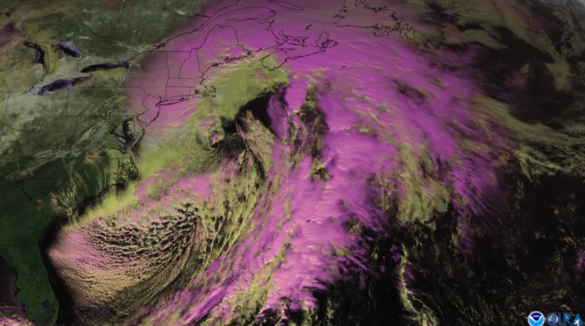
Nor'easter brings first snow, up to 10 inches, and season's coldest air
A storm becoming a nor'easter Friday brings cold rain to I-95 cities and the season's first accumulating snow to the interior Northeast and Great Lakes snowbelts. Weather service advisories in New York, Vermont and Michigan call for up to 10 inches in spots.
AI-assisted · US Brief desk · Sources listed below
What happened
A storm crossing the Ohio Valley on Wednesday is forecast to slide off the Mid-Atlantic coast and strengthen into a nor'easter on Friday, Fox Weather and weather.com reported. Behind it, colder air will give nearly every state along and east of the Mississippi River its lowest temperatures of the season so far this weekend, AccuWeather meteorologist Alex Sosnowski said, as quoted by USA Today.
Why it matters
For many of these communities this is the first snow of a fall Fox Weather called the warmest on record across much of the central and eastern U.S. The weather service warned of slippery roads during the Thursday evening and Friday morning commutes, and said the heavy, wet snow could cause isolated power outages. Weather.com advised drivers in the snow zones to slow down and watch for slushy roads at night, Thursday through Saturday.
What’s next
The chill should not last long. NOAA's Weather Prediction Center expects a slow warming trend toward early next week, and a Climate Prediction Center outlook favors warmer-than-average temperatures later next week for most of the nation east of the Rockies, USA Today reported, citing El Niño.
More context
Where the snow falls: The National Weather Service had winter weather advisories in effect Thursday morning for three areas. In Michigan's Upper Peninsula, the Marquette office expects additional lake-effect snow through Friday, with 3 to 8 inches over the higher elevations of Marquette and Baraga counties and up to 10 inches in rural areas north of U.S. 41 and west of Marquette County Road 510, but less than an inch near the Lake Superior shore, including the city of Marquette. The Burlington office expects 2 to 5 inches of wet snow, mainly above 1,200 feet, in western Essex County, New York, and eastern Addison and Rutland counties, Vermont, from 10 a.m. Thursday to 10 a.m. Friday. The Albany office expects up to 3 inches, with isolated totals of 3 to 5 inches on the highest peaks, in Hamilton and northern Warren counties in New York and above 1,500 feet in Bennington and western Windham counties in Vermont, from 10 a.m. Thursday to 10 a.m. Friday, and up to 4 inches above 1,500 feet in western Greene and Ulster counties in the Catskills from 7 p.m. Thursday to 1 p.m. Friday.
Private forecasters see higher spot totals. Fox Weather said Lake Placid, New York, could get close to a foot through Saturday, with 5 to 8 inches possible around Saranac Lake, Rutland, Vermont, and Marquette, and 5 to 8 inches from lake-effect bands near Valparaiso, Indiana, while Michigan City, about 20 miles away, may get only a coating to an inch. Burlington, Vermont, could see 1 to 3 inches, and Albany and Portland, Maine, a coating to an inch, Fox Weather said.
What it means for the big cities: Philadelphia, New York and Boston should get a cold, windy rain rather than snow, according to Fox Weather and weather.com. Weather.com said the nor'easter is not expected to be a high-impact storm: the low is not forecast to be very strong, flash flooding along I-95 is not expected to be widespread, and coastal flooding should be mostly minor at high tide. The weather service's Upton, New York, office has a coastal flood statement for southern Nassau County on Long Island for Thursday morning's high tide.
Frost and freeze farther south: Weather.com said the first freeze of the season could reach much of the Carolinas and northern and central Georgia and Alabama by the weekend, and recommended bringing sensitive potted plants indoors. Highs will be stuck in the 40s over much of the Midwest and Northeast from Friday through the weekend, it said.
Forecast at a glance (forecasts, not measured totals): Upper Peninsula, Mich., 3-10 in. (NWS); southern Adirondacks and southern Green Mountains, up to 3 in., isolated 3-5 in. on the highest peaks (NWS); Catskills, up to 4 in. above 1,500 ft (NWS); Lake Placid, N.Y., up to about 12 in. (Fox Weather); Valparaiso, Ind., 5-8 in. (Fox Weather); Philadelphia, New York City, Boston: rain, no snow expected (Fox Weather, weather.com).
What's still unknown: Weather.com said the storm is not expected to be strong, and USA Today, citing AccuWeather, said totals will depend heavily on elevation, temperatures and how hard the snow falls. Lake-effect bands are highly localized, Fox Weather noted, so one town can be buried while another 20 miles away gets a dusting.
4 listed sources
- National Weather Service active alerts (Marquette, MI; Burlington, VT; Albany, NY winter weather advisories, issued Nov. 11, 2026):
- Fox Weather, "Developing nor'easter could usher in first significant snow for the Northeast," Nov. 11, 2026:
- weather.com, "Nor'easter: Here's who has the best chance of accumulating snow," Nov. 11, 2026:
- USA Today, "A wintry forecast of snow and cold is about to take a turn," Nov. 11, 2026:
References listed by US Brief; a source count is not a verification score.
Editorial sourcing notes
All snow totals here are forecasts from the National Weather Service and private forecasters as of Wednesday, Nov. 11, and can change as the storm track shifts. Advisory times are Eastern.
Like US Brief? You can support it with a tip.